
Seeking Where Ancient Trails Meet History-An Interview with Historic Trail Explorer Nan-chung Young
According to Nan-jun Young, an honorary Ph.D. of Nat’l Dong Hwa Univ. and the most senior contemporary explorer of ancient trails in Taiwan, historic trails are“ the relics of history remaining on the surface of the earth, along which exist many ancient cultural remnants of indigenous tribes. They are not simply old-time routes but an epitome of Taiwan's history.”
For nearly half a century, Young has held a devotion to mountaineering, Austronesian studies, and historic trail relics studies; he has not only provided significant directions for research of historic trail in Taiwan, but reconstructed many historic relics that date back to a century ago.
Young had completed the climbing of Taiwan’s Top 100 Mountains as early as in the 1970s, and had been reputed for his idea and practice of academic mountaineering. But when he stood on the peaks, it was not the joy of conquering that filled his heart, but the call from such Japanese predecessor expeditionists as Mori Ushinosuke, Torii Ryuzo, Ino Kanori,and Kano Tadao: “Only when you climb up high will you gain a clearer view of Taiwan.”
Chopping into Discovery of Trails
“There is no cultural vacuum in high mountain areas that take up 3/4 of Taiwan; tracks of activities and cultural phenomena of aboriginal tribes never cease to exist over there,” declared Young, already 81 of age this year. “Exploring and investigating historic trails brings one the joy of discovery, and getting into the history and culture of our ancestors is the true meaning of climbing up high over Taiwan.”
Feeling urged as a Taiwanese to continue the studies previously conducted by Japanese scholars, Young embarked on his historic trail expeditions. Since 1985, when he had for the first time assisted Taroko National Park in the survey of Old Cross-Hehuan Mountain Road, Young has rendered survey reports on over a dozen of important historic trails located in Taroko, Yushan, and Shei-Pa National Parks or under the jurisdiction of Forestry Bureau. The existence of many legendary yet now desolate trail sections has been confirmed as Young trod over each one of them in person.
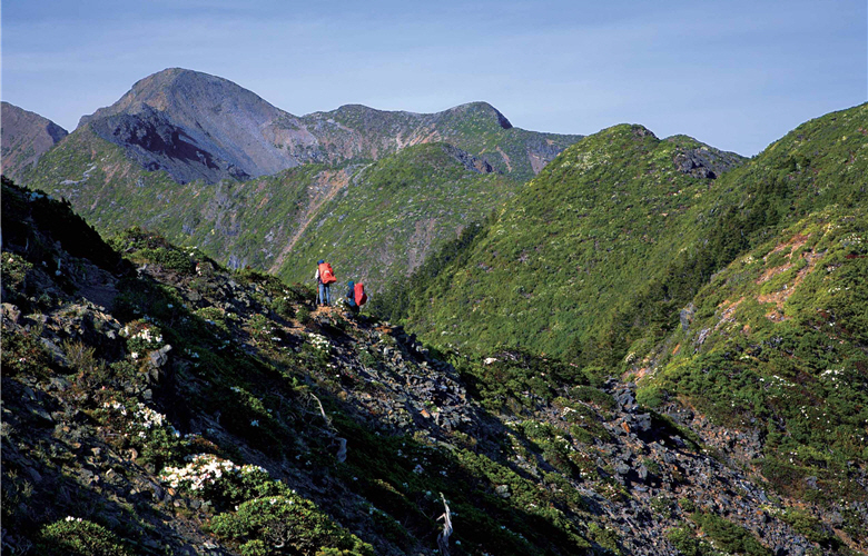
- upper:Only when you climb up high will you gain a clearer view of Taiwan./ by Min-zhi HongJUN. 2011
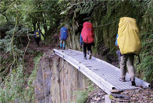
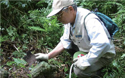
- lower left:Today's trail explorers are still challenged by such forbidding landforms as steep cliffs or plunging valleys./ Provided by YSNP Headquarters
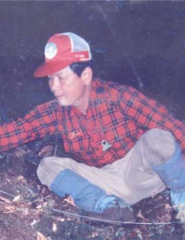
- lower right:A researcher of historic trails has to hack down the awns and bushes that cover trail subgrades before he or she conducts any measuring and takes photographs .
Text & Interview/Wan-ching Lai, Hsiu-mei Li
Photo provided by/Nan-chun Young
Translator/Chunyi Cheng
Many important historic trails are in fact east-west paths traversing the Central Mountains. Though spared from the “barbarian’s” killing, endemics or pestilences, today's trail explorers are still challenged by such forbidding landforms as steep cliffs or plunging valleys. “One step,one hack” is how Young described the difficulty of the work. “We had to hack down the awns and bushes that covered trail subgrades before every survey,” said Young. “It once took 2 hours to clean up a 64-step fan-shaped stone path at Batongguan Historic Trail.”
The Sherlock Holmes in Trail Exploration
One most rewarding action among Young’s numerous trail explorations is the search for “the real Qing Batongguan historic trail”in 1987. Most mountaineerers and scholars at that time mistakenly believed that the popular Batongguan hiking trail was restored from an ancient trail of Qing Dynasty. Young did not buy this hearsay, but decided to solve this mystery.
Young jokingly compared historic trail investigations to a master detective’s work, which requires complete equipment set for evidence collection. His own backpack contains a large tape for size or height measurement, a GPS for altitude measurement and positioning, and copies of topographic maps. Old maps frequented by Young include: Topographic Map of Taiwan Mountains (1:50000) published during the Taisho period,aerophotographs of the US Army (1:50000), military maps used in mountain battles, sketches of early anthropologist explorers, etc.
“Maps aren’t supposed to be carried in hand and referred to along the way, but to be well memorized before the journey and taken out only when further confirmation is needed,” advised Young.
Familiar with the landscapes of Taiwan and experienced in mountain hiking for long, Young encountered no hindrance in reading old maps. Sites with names as peculiar as Iron Gate Cave or Centipede Peak on historic maps from Qing Dynasty had been located one by one by Young within two years. He remembered having a nonstop walk for 13 days during his survey of the trail section between Dongpu Hot Spring and Yuli, looking for tracks among thorns and tough vines, traversing cliffs or crags in the day, and camping right on the ground or sheltering in caves at night.
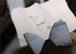
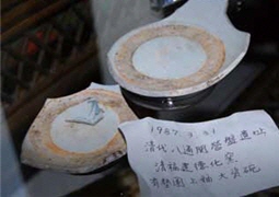
“The greatest pleasure came from unexpected discovery.” Young recalled how he had found the site of Qing military barracks in Batongguan, where many mountaineering teams of later times had camped without realizing what it was. Young had accidentally spotted two square walls covered by tall grass when he looked down from a higher point. “I knew right away what they are. The grass was especially dense because drainage ditches were dug around the barracks.” His intuition was later proved true when he dug out a great quantity of ceramics from Dehua Kiln and Anxi Kiln on that site.
- upper:Young has turned what he once trod into valuable cultural assets. There must be someone to follow his footsteps and protect what he had uncovered.
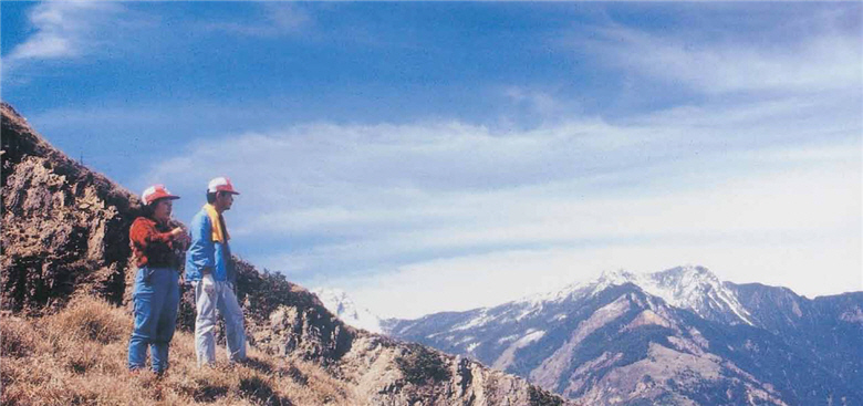
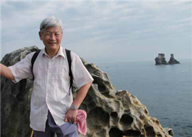
- lower left:Young is arguably the father of historic trail survey in Taiwan, and has trodden on each and every ancient trail several times.
- lower right:Ms. Ru-lin Xu draw the maps of the trails in detail, which well serve as precious historic data.
Way before the survey and related reports were completed, the Ministry of the Interior could not wait to designate the Batongguan Trail as a national historic site.Young’s discovery was announced by the Office of Information, and reported by media in Europe and America.
Identifying Trails with Careful Checks
Young stressed that in addition to careful cross-reference of maps of different periods and assiduous checks with historic data, the identification of historic routes demands “real actions,” including on-site inspection of recognizable route remains and interviews with local elder residents. He had once speculated that a specific ditch along the Jinshuiying Historic Trail had actually been a road but become a ditch after being repeatedly run over by ox-wagons. This conjecture was confirmed afterwards by local elders.
The most challenging cases are the abandoned trails, most sections of which have long become paddy fields or human settlements. In this case one can resort to a new tool of ancient trail studies : aerial photographs, on which linear extensions of ancient trails passing through modern settlements, or historic road tracks that have the same curves with the terrain, can all be observed.
A Special Bond Connected Through Trails
“It surely is a painstaking work, but I get immeasurable contentment during the riddle-solving process. Standing on the crossing point of history and geography, I seem to see people of different times, who had taken this very trail, and this thrills me. I wish my readers would have the same experience!” It is this passion that drives Young to reportage writing and translation. In his translation of Mori Ushinosuke’s A Journey on the Barbarian Land: Mori Ushinosuke’s Taiwan Exploration, Young made a comment on Mori, which fits Young himself just right: “the writing of [Mori Ushinosuke] is so detailed and lively that the readers are like being brought to the scene……They can almost smell it and feel the pulse of it.”
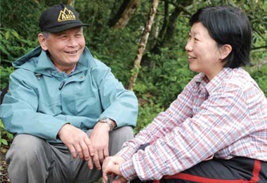
Since 1992 Young has explored many times the first trailblazing and aborigine pacifying route in Taiwan,Kunlunao Historic Trail, which had been trod by both Mori Ushinosuke and Torii Ryuzo 100 years ago. Young sent Torii’s son Torii Ryujiro some photos taken during his survey with a letter saying: “The plants beside the tilted slabstone house still flourish.” In his reply, 79-year-old Torii Ryujiro wrote: “Reading ‘the plants still flourish’ and recalling what Father had seen during his journey in Taiwan, I could not help but weep.”
It’s truly a blessing to have such an extraordinary, persistent, undaunted and passionate explorer as Young, who knows and discovered so much about the mountains. And it is our luck to get the cultural heritage passed down through his work, and our responsibility to follow his footsteps and protect what he had uncovered.

Nan-chung Young
Yang was born in 1931, graduated from the Dept. of Foreign Languages and Literatures, Nat’l Taiwan Univ., and once worked in a foreign institution in Taiwan. He started high mountain climbing at the age of 30, and had since committed to reestablish vanishing histories and cultural sites in Taiwan. After his retirement, Yang set up the Austronesian Cultures Studio, focusing on writing and translation as well as high mountain cultural survey and studies. In Nov. 2010, Nat’l Dong Hwa Univ. conferred its first honorary doctorate on Young, now a committee member of Taiwan Indigenous People Archives, in recognition of his persistent contributions to studies on aborigines.
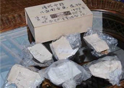
- Left to right (upper)::Original data for historic trail surveys are mostly historic maps from Qing Dynasty or during the Japanese rule,offering very limited and unverifiable information./ by Wan-ching Lai
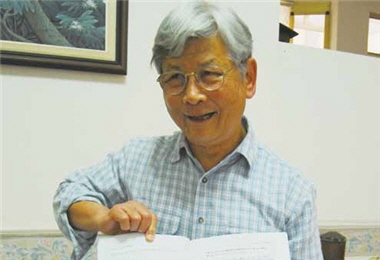
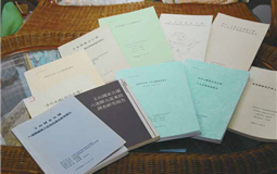
- upper:For the past two decades Young has surveyed historic trails for many government agencies, and wrote a lot of reports, laying an important foundation for historic trail research in Taiwan.
- lower center:Young surveyed Kunlunao Historic Trail several times, and, because of his surveys, he once had an emotive contact with the son of Japanese scholar Torii Ryuzo.
- lower right:A hacking knife and a measuring tape are the necessities in historic trail survey./by Wan-ching Lai
Types of historic trails in Taiwan :
Most historic trails were formed naturally after human treading, while some were official routes established by the authorities for political or economic purposes. Young roughly categorizes historic trails in Taiwan into the following:
community routes(indigenous affinity routes)
(border guard or Ai-yong routes)
(Japanese garrison routes)
(Qing historic routes)
Central Mountains built by the Qing government after the Mudan Incident, in order to
secure eastern Taiwan and encourage the Hans' settlement and cultivation over there.
Identifying the age of historic trails :
The Qing and the Japanese people constructed mountain routes with different methods and measures.
The construction date of a historic trail can be determined by identifying the following attributes:


