Badagang: A Grand Historical Canyon Lingered with Memories-
Badagang is a river terrace on the north shore of the Liwu Creek, the former traditional settlement of a tribe. Today with the national park renovation of the Zhuilu cliff, after hiking was opened to the public, the daily flocks of tourists use this location a starting point to move in and out of Zhuilu Cliff, making the Badagang an internationally renowned attraction. In addition to the natural landscape, Badagang plays an important role in history since it happens to be located on a historic path, so it carries a diverse cultural heritage and possesses a rich meaning in cultural location and landscape.
The Ancient River Terrace that Nurtures Canyon Civilization
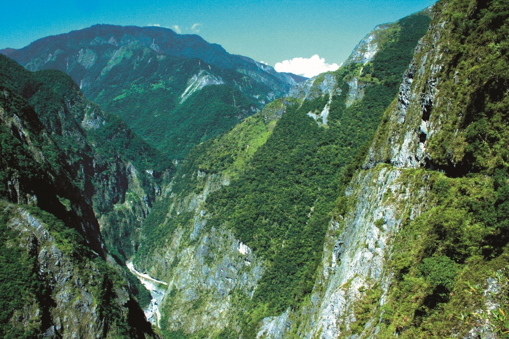
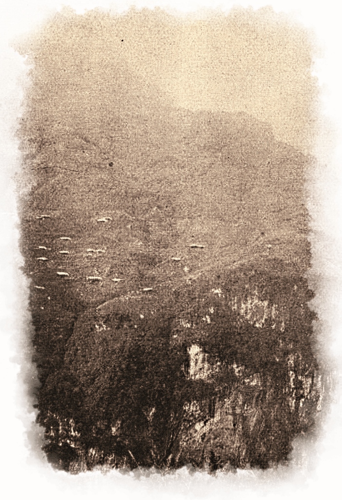
The Badagang terrace is approximately 450 meters above sea level and is located on the south side of the mountain that extends to the west of Mt. Sanjiaozhui. This ancient river terrace faces toward the Liwu Creek. Mt. Sanjiaozhui, with an altitude of 2,607 meters, acts as a protection wall at the north side of the platform and the Badagang River that runs through the west side of the platform forms a three-sided cliff surrounded by dangerous environment. Through downcutting of the creek, the river bed of the Liwu Creek tens of millions of years ago has caused the river to have parts of the remaining river bed. These parts of the river bed form a stair-like little platform, which is the river terrace. The numerous terraces at the shores of the Liwu Creek have become the cradle that nurtures the Taroko Gorge civilization.
The Taroko tribe who migrated from their birthplace 300 years ago, established the Badagang tribe here at the terrace. Bagadang in tribal language means bamboo. At the Taroko Gorge where lands are very few, the nearby tribal community are scattered in few and dangerous sloping lands facing the Liwu Creek. The main tribe of this area is roughly bounded by the Badagang Creek, which divides the Bartolan community of the West Bank Slope (not the same name tribe of the Papaya river basin) and the Badagang Community of the East Bank.
In addition, some small tribal communities including Alulin Community of the Zhuilu Mountain top also scattered in the area. As the tribal communities of the Taroko Gorge, they are independently standing at the top of the canyons, overlooking the cliffs known as the Yayung paru (“large river” in tribal language) or the Liwu Creek.
Taroko during the war
In 1914 (Taisho year 3) during the Taroko war, the Japanese army attacked downward from the west road of
the Hehuan Mountain. The army joined with the police team who entered the Liwu Creek by stream trekking
from the creek entrance. They attached from both sides and invaded Taroko.
At the end of June, the leader troop of the Japanese army entered the midstream area of the Liwu Creek and
climbed up the main ledge of the Pyramid Mountain. In the midst of afternoon mist, the army scout discovered
the tent used by the stationed police troops down the mountain. After both troops contacted each other by using trumpets and flags, the scouting troops passed through Badagang in the evening, went down offshore the Liwu Creek and obtained contact with the police troop. They were the first ones to geographically cross the Taroko. A few days later, parts of the army from the mountain top came down from the mountain. At Buluowan, the first meeting between the army and police troops then took place, which declared the outcome of the Taroko War.
This military emergency road that passed through Lao Xi, Zhuilu Mountain, Badagang to Buluowan not only opened up a passage into the Mt. Sanjiaozhui that acted as a natural barrier, but also established the basic prototype of the future road. At the end of the following month, the police troops who climbed up the Badagang terrace began to enovate this road that passed through the Mt. Sanjiaozhui so that it could become a formal road. Because the road starting from Badagang and ending at Mt. Sanjiaozhui was directly saddled on the west side of Mt. Sanjiaozhui, therefore, this road is called the Mt. Sanjiaozhui Large Mountain Saddle Road.
The first Native Formosan Supervisory Center
After the end of the Taroko war, the Karenko Prefecture announced the establishment of two branches including
“New Town Branch Hall” and “Inner Taroko Branch Hall”. The “Inner Taroko Branch Hall” was located in Tabito (Tianxiang). In addition, in order to suppress the Taroko tribe, the Office of the Governor General utilized the road foundation that was laid during the war period. This passage extends from the mouth of the creek to the Takkiri native Formosan Picket Line and has become the Inner Taroko native Formosan Picket Line.
Along the Liwu Creek, the Inner Taroko native Formosan Picket Line has established 8 native Formosan Supervisory Centers, which acted as the commander centers. The geographical locations of these centers are advantageous. The centers are also at the Badagang and the entrance of Mt. Sanjiaozhui. They became the first choice of the native Formosan Supervisory Center.
The officials therefore established the “Badagang Native Formosan Supervisory Center”. In October 1914, the officials completed the setup of the garrison facilities and manpower. The administrative area of the “Badagang Native Formosan Supervisory Center” covers the The Native Formosan Picket Line along Badagang Buluowan and the branch Hall at the Zhuilu Mountain peak. This surveillance district included, 12 “native Formosan dispatchers” that were scattered on the native Formosan Line. Because its geographical location was midway between the entrance of Taroko Gorge and Tabito Branch Hall, its location is therefore extremely important. In addition, the distance from the canyon entrance to this center was approximately 1 day walking distance. Badagang has also become the relay station for the police and security officers who entered in and out of the branch halls.
The Traffic Hub that Cross Over the Mt. Sanjiaozhui
In the early spring, during March of 1915 (Taisho year 4), the first modernized road, the “New Town Inner Taroko Road” that connected New Town to Tabito Branch Office was declared completed, overcoming the danger of the canyon. The work was led by Umezawa Masa from the Police Department of the Karenko Prefecture.
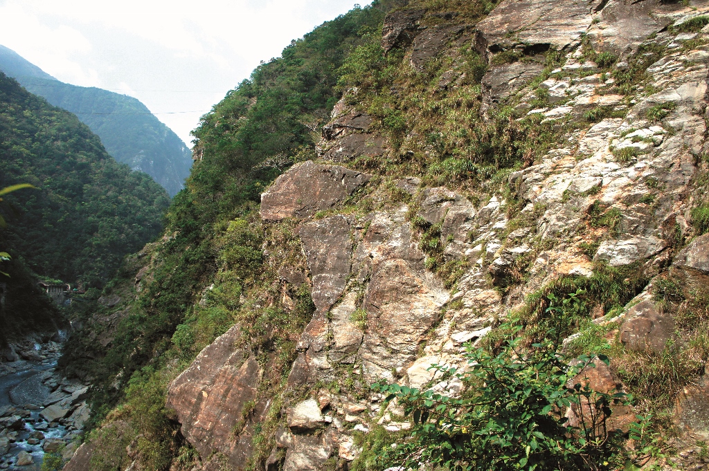
Downstream of the Liwu Creek, there are two peaks, each reaching a height of up to two thousand meters
respectively. They are the Mt. Sanjiaozhui of the north shore and the Ta Mountain of the south shore. The two
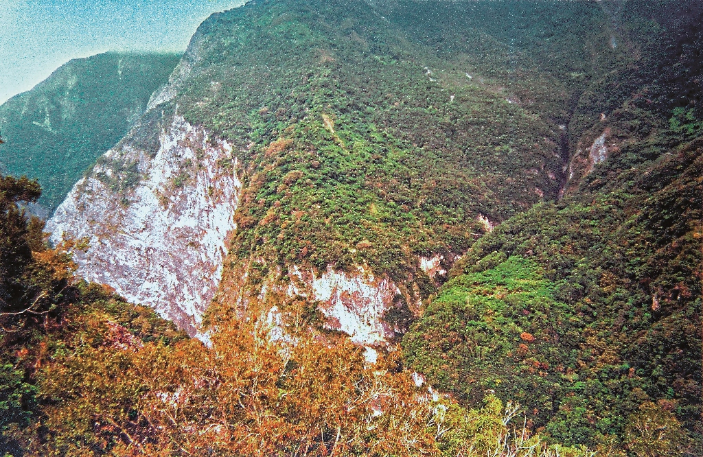
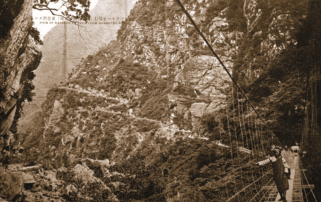
mountains intersect at the bottom of the Badagang. These mountains form the marble canyon terrain. The Liwu Creek was formed between these two mountains, forming a deep canyon with cliffs on the two sides. This formation is the section we can see today extending from the Swallow Grotto to Tunnel of Nine Turns. When the new road was constructed, this narrow water passage was hard to break through. Back then, the engineering technology could not construct a passage through these areas. The only way was to cross over from the top. Therefore, Badagang River Terrace acted as a location of rest at the screen-like cliffs of Mt. Sanjiaozhui. This platform continues to be the first choice of the way to the main road.
Therefore, the “New Town Inner Taroko Road”, which is the passage that started from the Shanyue Bridge crossing over Badagang, largely followed the moving line from that of the native Formosan picket Line period. In order to decrease the danger of using a wooden ladder to vertically climb over the native formosan picket line, the construction team established a new Shanyue Bridge river to cross over at the downstream site. They also blasted off the rocks to set up a permanent road foundation at the Linxi Mountain Wall at the north shore. The new road is smooth and easy to travel on, which enhances the safety of the traffic. Because the moving line of the road rises up in a zigzag way, from far away, the road looks like the lightning zigzag shape.Therefore, the visitors called it the “Badagang Lightning Road”.
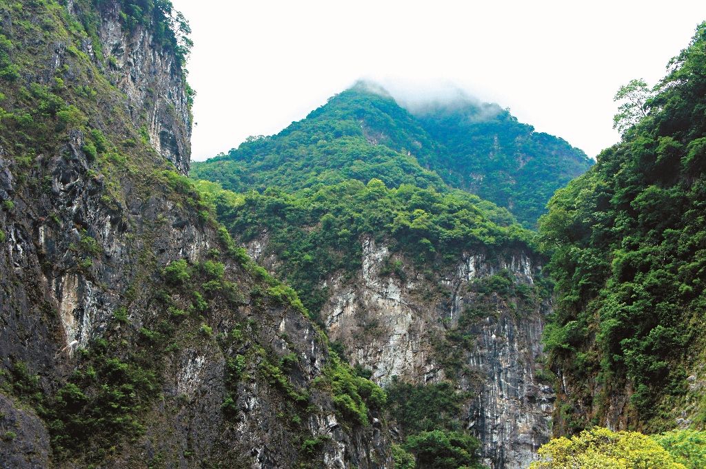
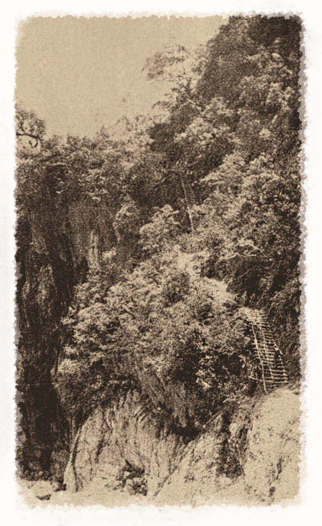
After passing through Badagang , the new road has improved the inconvenience of climbing the “Sanjiaozhui Large Saddle Road” in the past. After crossing over the Badagang Bridge, the road passes along the contours of the new road, directly crossing the large cliff southwest of the foot of the Mt. Sanjiaozhui. At the marble cliff, a cliff road of one kilometer was constructed called the Cliff Road. The turning point of the mountain on the cliff road was located at the foothill ridge line of the southwest of Mt. Sanjiaozhui and was therefore named Zhuilu. The site has become the Zhuilu Large Cliff as we see today.
Following one year after the Taroko War, constructions of roads continued to be performed. The Mt. Sanjiaozhui Large Saddle Road construction that utilized the natural terrain and the Cliff Road construction that excelled in engineering technology both utilized Badagang as the stronghold, which became the portal that guarded over the Mt. Sanjiaozhui and the traffic hub of the intersection of the two roads. This has made Badagang become an essential stronghold of road guards.
Praising the Twelve Scenes of Taroko
The tourism of Taroko began in 1927 (Showa Year II). After Taroko was selected as the Eight Scenes of Taiwan, it brought about a new wave of tourism. The Badagang Terrace was intentionally transformed into a Japanized landscape by the police officer who was stationed here. Therefore, cherry blossoms were widely planted at the platform. During cherry blossom season, numerous cherry blossoms would be in full bloom. Therefore, the
Cherry Blossoms of Badagang became a scene listed as one of the Twelve Sceneries of the Taroko during Japanese rule; the scenery has become a far well known canyon scene. In addition, the Zhuilu Cliff, which has a reputation of The First Large Cliff of the Eastern Sea has attracted numerous crowds of tourists. They utilize Badagang as the site of staying overnight for the tour. After a night of rest, the tourists then travel to the Large Cliff the next morning or they would continue to travel to other sites.
This culmination of tourism started in 1934 (Showa Year 9), when in 1934 (Showa 9 years), the Hehuan Crossing was constructed that passed through Karenko Prefecture to Taichung State. The culmination of tourism reached its peak in the following year, when application for the entrance to the aboriginal site at the Large Cliff was no longer necessary. Perfect accommodation, dining, medical facilities, daily living materials, and the sale of aborigine souvenirs allowed Badagang to become the 2nd essential tourist site (1st was Tabito) in inner Taroko.
Important Historical Sites
In addition to the Zhuilu Cliff, which is known as the “Largest Cliff in the Eastern Sea”, Badagang and its surrounding sites have many well-known attractions and cultural history.
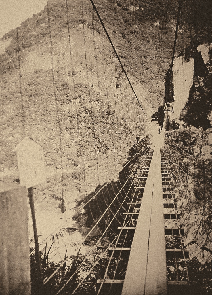
Shanyue Bridge
The Shanyue Bridge has gone through renovation and constructions many times. The bridge of the first generation was 154 meters long and was built in 1914 during the Taroko War period. After raising its height, the bridge of the second generation was 190 meters long and 75 meters high. It was built in December 1930 (Showa Year 5); this bridge was the longest iron wire bridge in Taroko. During the construction of The Gold Production Road, the bridge of the third generation fell down due to the cracks in the foundation of one side of the bridge. Then the bridge was demolished and was reconstructed at the upstream site in August 1941 (Showa Year 16).
The Shanyue Bridge crosses over the two shores of the Liwu Creek and is the gateway to Badagang. This bridge is also named Resignation Bridge, which reflected the emotional state of the police officers stationed in the aborigine area. They were homesick and showed difficulty adjusting to the exotic environment. Because it is the longest bridge of the Taroko, looking at the Shanyue Bridge far away was like looking at a long rainbow over the canyon. One can feel the cool canyon wind while standing on the bridge. However, the bridge usually shakes quite wildly while walking across it.
This swinging of the bridge has caused even people who are usually bold to feel afraid. Often there were tourists who admired Taroko for its renowned reputation but encountered difficulty in moving forward at the Shanyue Bridge. They could not overcome their fear, and the tour of Taroko became incomplete. In contrast, the experienced police officers stationed in the aborigine sates and the tribal people who lived here could cross over the bridge easily and quickly. They expressed no hesitation, showing great contrast compared to the tourists who could not move even one step. Today, the Shanyue Bridge still has remains of complete. However the bridge still retains a complete bridge pier, bridge embankment, and a bridge cable anchor. Although the function of the bridge has been lost, the condition is still good. It is an important historical site that has witnessed the history of Taroko.
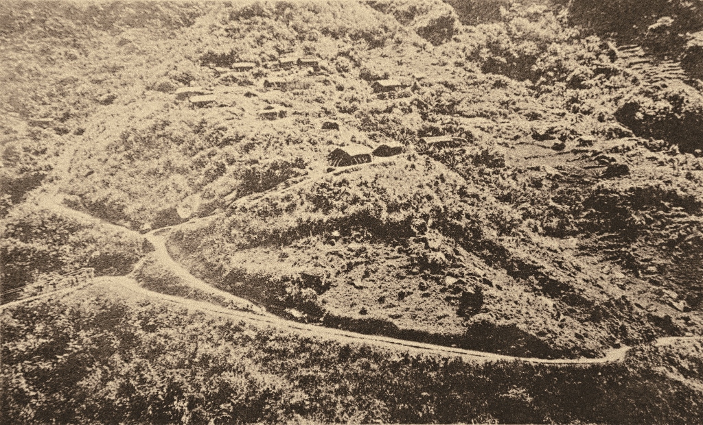
Badagang Lightning Road
The Badagang Lightning Road starts from the Shanyue Bridge and ends at Badagang; its official distance is 13
cho (approximately 1,400 meters). After one climbs up approximately 200 meters, one can reach the Badagang
Terrace. The lightning road is divided into 10 equal parts. These parts are called 10 stations and at each station, a road sign is set up to encourage the tourist who experienced difficulty going up the slope. The 10 stations, are listed in order, with the Shanyue Bridge designated as the 1st station. Approximately halfway is the 5th station where bamboo chairs are available for the tourists to take a momentary break. At the 8th station, one can see the Badagang Terrace. When you arrive at the 10th station , you have reached the entrance to the Badagang Terrace.
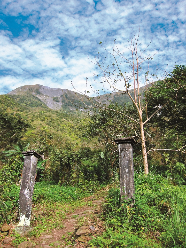
With the destruction of the Shanyue Bridge at the end of the Japanese rule, the entrance to the Badagang Lightning Road disappeared and was abandoned. Today, the national park has renovated the hiking trail which reaches the Badagang. A new bridge crossing the river has also been set up upstream of the old road; this Lightning Road is no longer in use. Now numerous sections of the roads at the cliff have collapsed, but the sections that are constructed on top of the hard rocks have been kept. These sections of roads hang quietly alone above the towering cliffs.
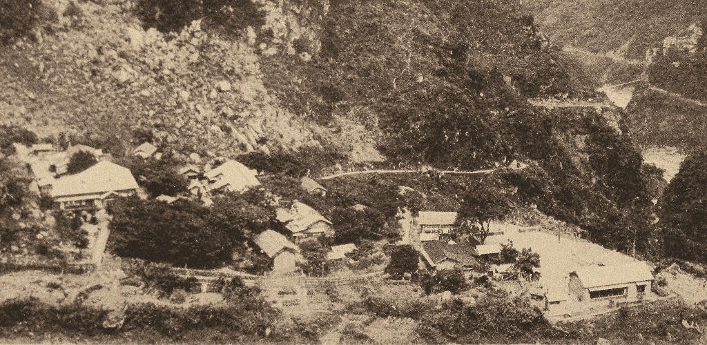
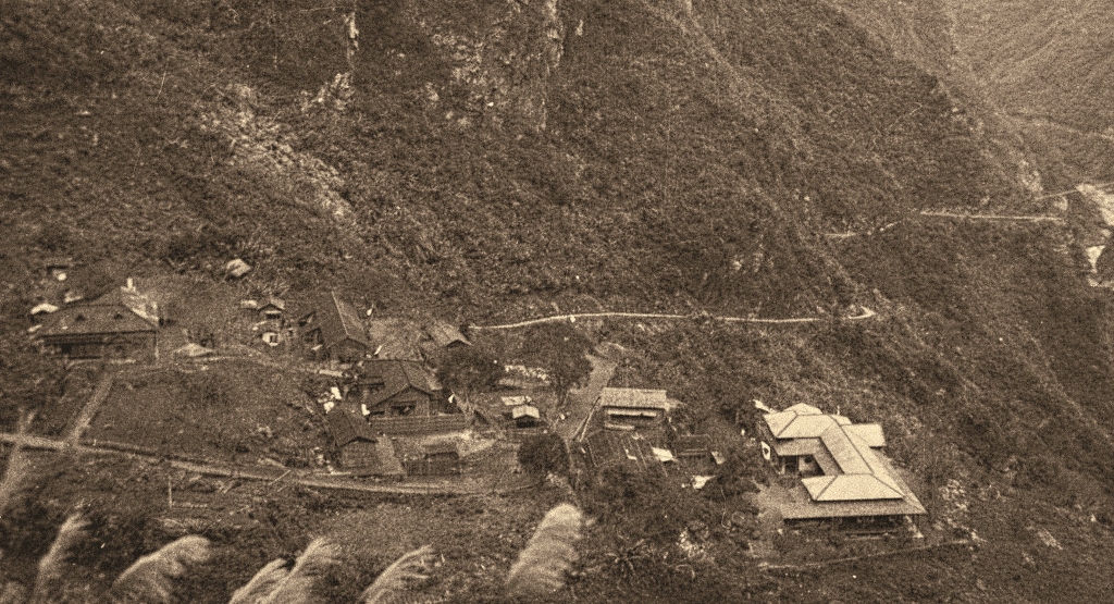
Badagang Terrace and its Roads
The Badagang Terrace can be roughly divided into two major areas including North Platform and South Platform. The North Platform is located nearby the main ridge of the Mt. Sanjiaozhui. The platform is an inclined slope. In the past, it was called the residential area of the aborigine where tribes and homes are located. The South Platform serves as Badagang’s main administrative center. The slope of the South Platform is less inclined and forms three small platforms including upper, middle, and lower platforms.
1. The most southern side is the lower platform, which is the largest hinterland of the entire Badagang Terrace. The lower platform that faces the Liwu Creek is the cliff area. In the past, it was called the Badagang Education Institute. In April 1934 (Showa Year 9), in response to the demand for tourism, the original site was converted into a public accommodation called “Taroko Pavilion”. In addition, the supply of daily necessities of the "bartender", is also located in the lower platform.
2. The middle platform is the Badagang Police Station and the police hostel.
3. The upper platform is another hostel building called the Badagang Club.
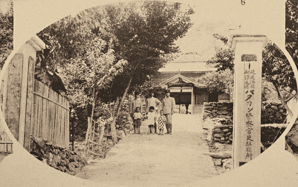
Badagang Police Official Station
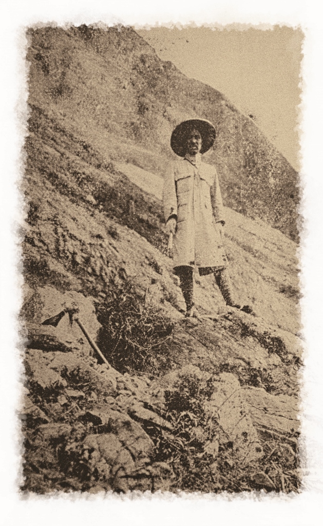
The Badagang Police Guard Agency, established after the Taroko War, experienced numerous road alterations
including the 1st native Formosan picket line, Inner Taroko Police Guarded Road, Hehuan Crossing Road, and Gold Production Road. During this period, the Station also went through numerous restructuring of tasks. After numerous streamlining and reorganizations of surrounding police official agencies in the Taroko area, Badagang Police Guard Agency was preserved. At the end, it is one of the few police official agencies that remained in operation in Inner Taroko during the days when Japan was defeated. Also, between 1914 and 1945, the period when Office of the Governor General ruled Taroko mountains, it was one of the few police official agencies that stayed in operation since their first establishment until the very end. It is evident that the Badagang Police Guard Agency serves an essential role.
The security guards who were stationed here followed the police station leveling of 1938 (Showa Year 13) during
the last years of Japanese rule.
The leveling of securityguards included one inspector minister and two inspectors. The Badagang Police Guard Agency has been renamed and reorganized several times. Finally, in August 1945 (Showa Year 20), the agency was abandoned as the Japanese rule period ended. In March, 1946 (Republic of China Year 35), the National Government ordered a formal abolition of the agency.
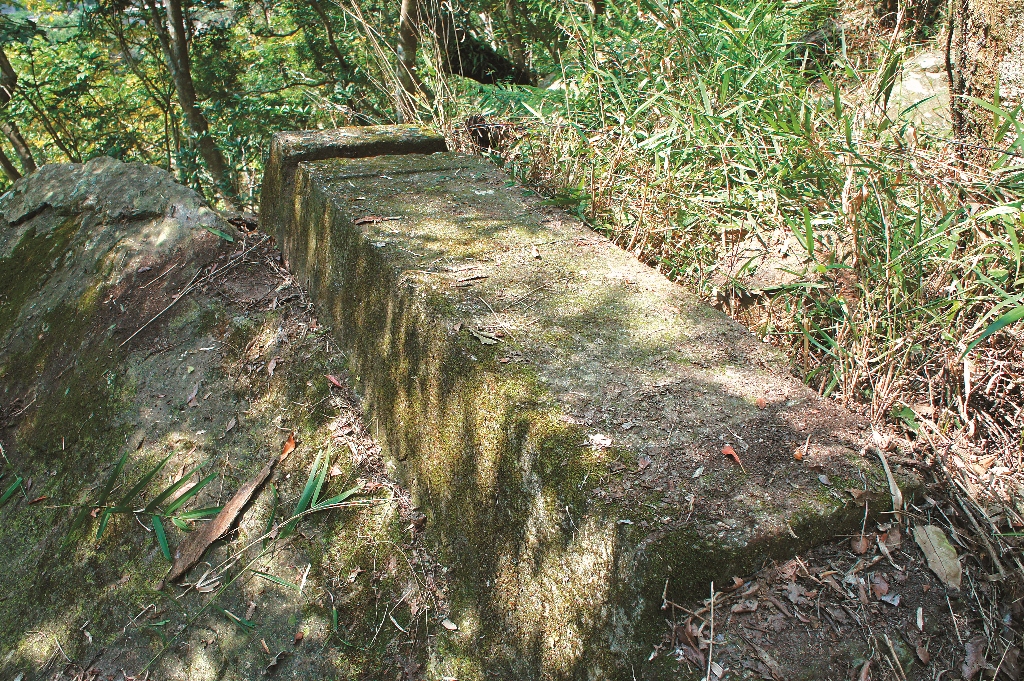
After the officials of the Taroko National Park made some rearrangements, the buildings of Badagang Police Official Station showed a clear picture of the past daily lifestyle. This includes the appearance of structures such as the door post of the station, the former passageway, the ruins of the Bagadang station at the east side of the passageway, and the ruins of the police hostels at the west side of the passageway. The Station is the most accessible historical site of the current Badagang Terrace.
Badagang Club
As the most essential resting station in the Taroko Gorge, Badagang is the final destination of a one-day walk. Ordinary travelers start out from the entrance of the canyon in the early morning and arrive at the Badagang accommodation before the evening. The next morning, they would head toward the large cliff of the Zhuilu. Then, the travelers would return to the starting point or continue toward the west. As the eight scenic spots became popular, the number of Taroko tourists gradually increased.
Therefore in 1929 (Showa Year 4), at the rear of the Police Official Station, accommodations were planned and constructed. This accommodation was called Badagang Club. In the Badagang Club, there are guest rooms which are eight jo (4 ping) in size. The three guest rooms were set up with bathrooms. Because of the low cost, one dollar for one night of stay, the club was widely popular. The club became the most important in the early days of tourism.
established at the lower platform of the Badagang in 1916 (Taisho Year 5)
dismantled the site of the Badagang Aboriginal Children’s Education Institute.
The Taroko Pavilion was constructed.
Badagang Education Institute, Taroko Pavilion
In 1916 (Taisho Year 5), the authorities of aboriginal affairs established the “Badagang Level B Aboriginal
Children’s Education Institute” at the lower platform of the south side of the Badagang Terrace. The stationed
police officers served as teachers to promote assimilation education. Students were tribal children from around
Badagang. In 1928 (Showa Year 3), the education institute was reorganized and renamed “Badagang Children’s Education Institution”. Since then, as the Karenko Prefecture began to actively promote the Taroko Gorge., activities such as petitions and promotions to campaign for it to become a national park began to flourish. Until Showa Year 8, the capacity of the Badagang Club was insufficient.
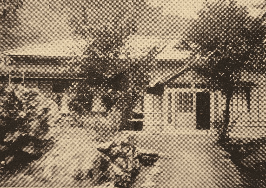
Therefore, in March 1934 (Showa Year 9), authorities selected the site of the Badagang Children's Education Center, which was relatively wide in hinterland. This original education institution was abolished then demolished and the Taroko Pavilion was constructed at this location. The Taroko Pavilion is 87.5 ping. It included one 10-jo (5 ping) guest room and four 8-jo (4 ping) guest rooms.
In addition, other well-thought out facilities included a bathing room, dressing room, toilet, and kitchen. A total of about 30 guests can be accommodated and the charge was 1.5-3.5 Yuan. The Taroko Pavilion utilizes cypress wood and incorporates an entirely new design; it is also known as the “Taroko Cypress Royal House”.
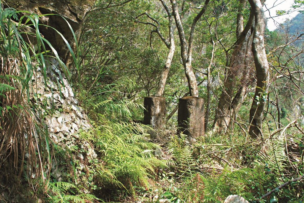
At present, the weeds flourish at the lower platform of Badagang. Among the woods is the tilting door post, vaguely visible. Its shape is consistent with that of the Badagang Police Official Station showing that it was the ruin of the Badagang Education Institute. The Taroko Pavilion or socalled Taroko Cypress Royal House that replaced the original building site showed only the past remaining construction foundation stretching horizontally from east to west.
Badagang Bridge
Starting from Badagang and heading west toward the large cliff, the Badagang Bridge crosses the Badagang Creek at the level ground of the mountain. The Badagang bridge is 67.3 meters long and 63.6 meters high.
After tourism flourished in Taroko, the number of tourists who came to visit this renowned site increased. Then, the Badagang Bridge was renovated and rebuilt in September 1930 (Showa Year 5). The Badagang Bridge has now disappeared and the ruins of the old bridge has been converted into the Badagang Bridge No. 2, which continuesto be used by the hikers who head toward Zhuilu Historical Trail.
The Elegant Beauty of History Extends Once Again
Taroko Gorge is known for its high mountains and deep valleys. In this environment of deep and serene shores, the river terrace platform has become the bearing containers for the culture of the canyon. After becoming the residence of the tribes 300 years ago, Badagang has become the stage for witnessing the Large River culture. These cultural events included Taroko tribal people establishing their tribal communities, the site where Army and Police Officers met during the Taroko War, the very first native Formosan inspector agency, the entrance to the “Largest Cliff of the Eastern Seas”, and the representative scenery of the “Twelve Sceneries of Taroko”. In the valleys, the Liwu Creek carved out river terraces over tens of millions of years. On the platform, people stopped, came and went, stacking the content of history.
In the occasional chance of history, because of Badagang’s importance in traffic, it has become essential hub. However, today the road has disappeared, the flow of traffic no longer exists, and Badagang can then retain its legacy. The time can be sealed in the corner of the platform at the cliff. The rich and diverse human landscape of Badagang has collected precious cultural assets of the valleys. The epitome of the history of Taroko continues to richly unfold above this wonderful river terrace platform.
About the Author
Hsang-Te Chin Intermediate mountain hiker and old trail higher and explorer. He has written books such such as "Hundred Yearof Liwu Creek".