

Article / Tso Mei-Yun
Photo / Chen Chung-Neng
Interviewees / Chen Ming-Chu, Interpreter, Xuhai–Guanyinbi Nature Reserve Lin Chiung-Yao, Senior interpreter, Kenting National Park Headquarters
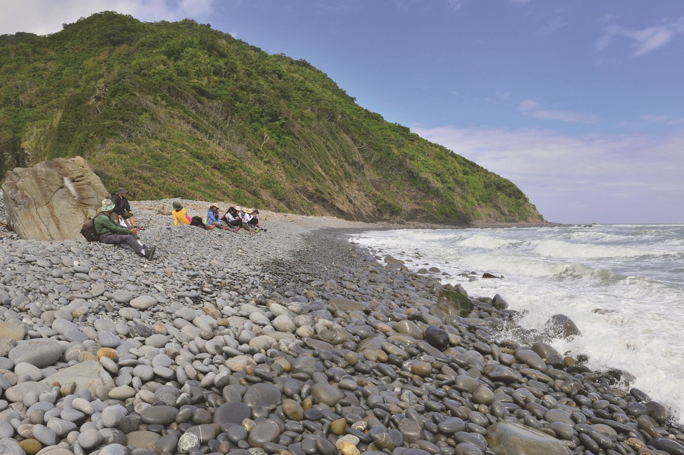
The Xuhai–Guanyinbi Nature Reserve, located in southeastern Taiwan, is regarded as the most intact and least disturbed natural coastline along Taiwan’s 1,200-kilometer coastline. No roads lead directly into the area, and along the coast, the only signs of life may be sea turtles or cetaceans surfacing occasionally—there are no artificial embankments or concrete tetrapods in sight.
The reserve is home to representative lowland old-growth forests, land crab ecosystems, and remarkable geological landscapes, all of which are ecological treasures. In addition, the Alangyi Historic Trail, which runs from Nantian in Taitung to Xuhai in Pingtung, is known not only for its magnificent scenery, but also for the stories of hardship endured by migrating Indigenous communities. The origin of its name is itself a fascinating story shaped by historical coincidence.
A Wild and Untouched Coastline
Taiwan, uplifted from the seabed by tectonic forces around 6 million years ago, is a mountainous island surrounded by the ocean. Its complex geological formations have created rich and diverse coastal landforms, giving rise to world-class natural scenery and geological landscapes that fully justify Taiwan’s nickname, the “Treasure Island.”
Covering 841.3 hectares, the Xuhai–Guanyinbi Nature Reserve borders the Pacific Ocean to the east and the southern end of the Central Mountain Range to the west, forming a long, narrow, and intact natural corridor. The reserve preserves extensive lowland old-growth forests and coastal ecosystems, making it an important wildlife habitat.
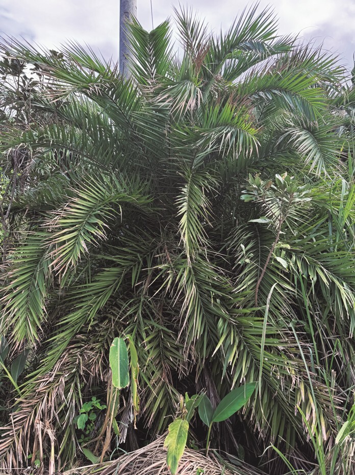
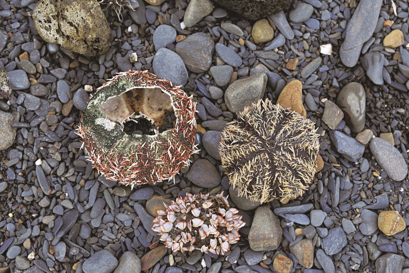
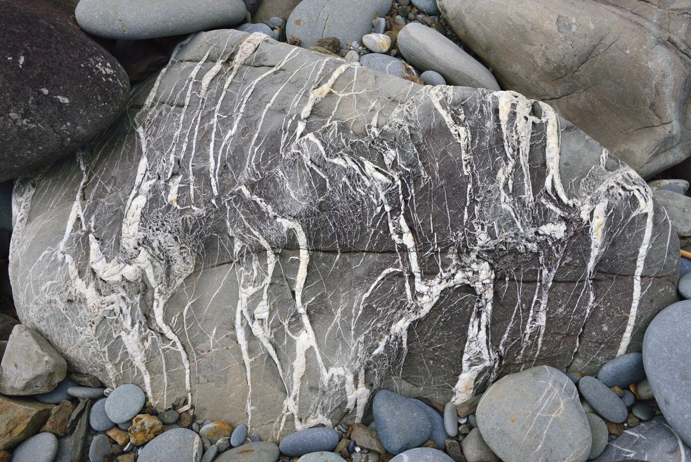
According to statistics from the Pingtung County Government, the reserve is home to 18 endemic plant species, 22 endemic animal species, and 46 protected animal species. Its rich biodiversity has made it an important site for academic research and ecological conservation, earning it a reputation as a treasure trove of biodiversity has made it an important site for academic research and ecological conservation, earning it a reputation as a treasure trove of biodiversity. The reserve also features distinctive geological landscapes, including the folded rock formations and sedimentary rock structures of Mount Mudanbi and Mount Guanyinbi, as well as the Nantian gravel beach, all of which are valuable natural resources.
.JPG)
A Crossroads of Migration and Cultures
The establishment of the Xuhai–Guanyinbi Nature Reserve not only preserved an untouched stretch of coastline, but also safeguarded important historical traces, giving the area exceptional cultural significance.
Due to its strategic geographic location, the Hengchun Peninsula became a crossroads for migration and cultural interaction from the 16th century onward. Indigenous peoples, Han settlers, Plains Indigenous peoples, and Hakka communities all migrated to and converged in the region. The interactions, conflicts, and integration among different groups, along with shifting political power and the rise of influential figures, shaped one of the most important chapters in Taiwan’s history. To this day, the area continues to attract historians, researchers, and writers seeking inspiration and historical insight.
In the mid-17th century, before foreign powers arrived in Taiwan, the Puyuma people of Zhiben in present-day Taitung migrated south to Langqiao, the former name of Hengchun. Through military strength and spiritual authority, they established the four major Seqalu communities in Langqiao and became the dominant power in southern Taiwan. During the Qianlong period of the Qing Dynasty in the 18th century, the Zhu Yigui and Lin Shuangwen uprisings prompted many Hakka people from Pingtung’s Liudui region to migrate south to Baoli in Langqiao. Another major wave of migration followed in the early 19th century, when the Makatao people of the Pingtung Plain, displaced by expanding Han settlement, and the Amis people of eastern Taiwan, pressured by the Puyuma, also moved south to the Hengchun Peninsula.
By the late 19th century, advances in maritime technology led to increasingly active sea travel, dramatically changing the fate of the Hengchun Peninsula. Shipwrecked foreign sailors were killed by local Indigenous peoples, triggering a series of international incidents.
The most representative of these was the Mudan Incident of 1874. Following the incident, the Qing government began extending its administration into Langqiao, leading to conflicts with local Indigenous groups. To escape the turmoil of war, many people crossed the Central Mountain Range into eastern Taiwan, where they established new settlements.
Over time, these scattered refugee settlements gradually developed into larger tribal communities known collectively as Aljungic, meaning “bringing small things together into something larger.” Han intermediaries transliterated the settlement’s name in several ways, including Alangwei and Alangyi, while the nearby stream became known as Alangwei Stream.
An Imperial Commissioner and the Rebuilding of the Trail
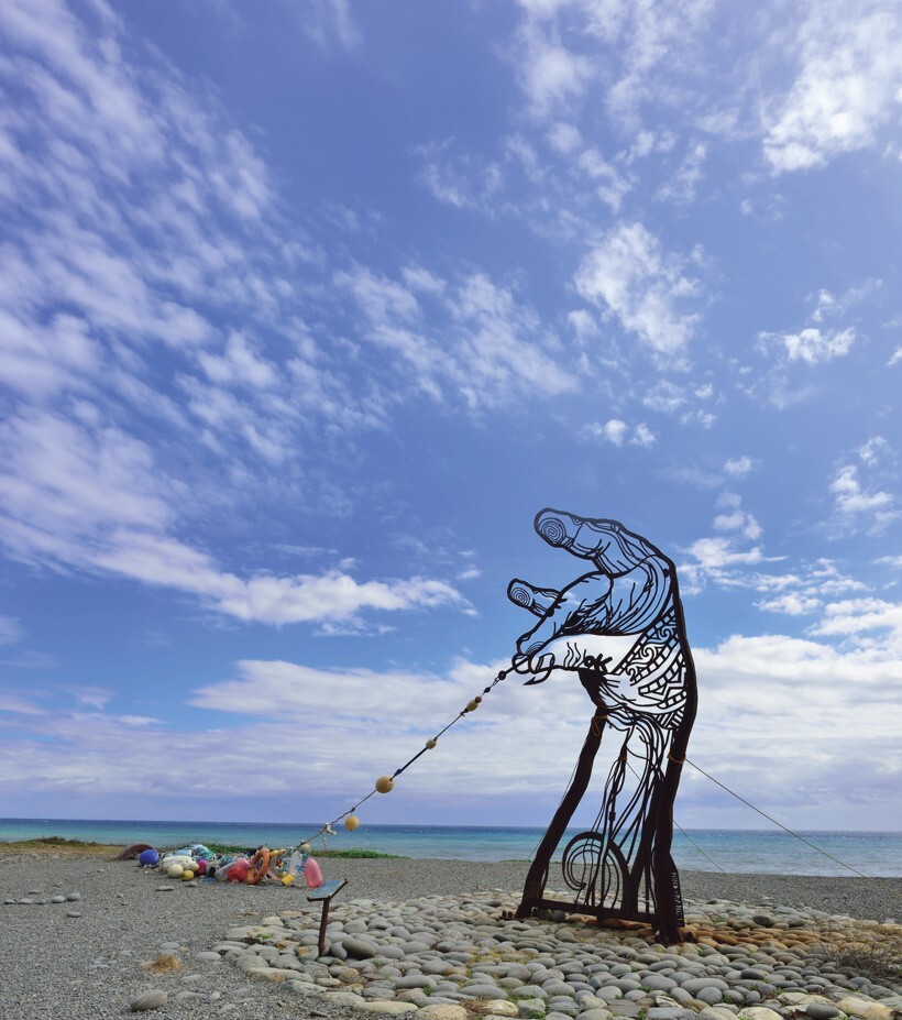
The migration routes across the Hengchun Peninsula were once lively corridors marked by both prosperity and hardship. Along these roads traveled the Seqalu, Paiwan, Amis, and Makatao peoples, as well as Hoklo and Hakka settlers. Dutch people seeking access to the eastern gold fields also passed through Langqiao. In 1874, the Qing court dispatched Imperial Commissioner Shen Baozhen to Taiwan. Determined to improve transportation and communication, Shen implemented a series of policies, including “opening the mountains and pacifying Indigenous peoples,” constructing mountain trails, and encouraging migrants from Fujian and Guangdong to settle and cultivate land in Taiwan.
In one memorial to the Qing court, Shen Baozhen wrote: “It is now late winter, yet the wheat and rice shoots are already green and golden, resembling the scenery of April on the mainland.” He proposed renaming Langqiao as “Hengchun”, establishing a county seat and building a city there, while also constructing an official road linking Hengchun and Beinan. Starting from the East Gate of Hengchun City, the road passed through Shemali, Mudan Bay, and Alangyi Stream before reaching Beinan. Known as the Hengchun–Beinan Trail, the route extended 213 Chinese li (approximately 120 kilometers) and later became an important official thoroughfare. The road was broad and relatively level, wide enough even for ox carts to pass through. During the Japanese colonial period, the Hengchun–Beinan Road was further widened into a designated roadway accessible to automobiles.

Just how wide was the trail? Chen Ming-Zhu, who returned to Xuhai in 1984 and later worked as an interpreter, recalled local stories passed down through older generations. According to one account, the mother-in-law of a former village chief traveled from Nantian to Xuhai for her marriage, bringing an entire ox cart of dowry with her. Another interpreter recalled that his grandfather had once driven a bus along the trail. These stories testify to the former prosperity of this coastal route. Today, however, parts of the trail have disappeared beneath the sea and are no longer passable, making ox-cart travel unimaginable. Visitors reaching Mount Guanyinbi must now climb stairs and take a higher detour around the headland.
What is now commonly called the Alangyi Historic Trail is in fact only the Xuhai–Nantian section of the old Langqiao–Beinan Trail. According to Lin Chiung-Yao, historical records show that this route was already known during the Dutch period in the 17th century. Historic trail writer Yang Nan-Chun once conducted interviews with Pan Yao Lung-Mei, the granddaughter-in-law of Pan Wen-Jie (1854–1905), the last chief of the Seqalu people, while researching the history of the trail. Pan Wen-Jie, the chief leader of the Seqalu and the Eighteen Tribes, played a key role in mediating between the Qing government and the Japanese during the Mudan Incident, and later assisted in the construction of Hengchun’s city walls, making him an influential historical figure.
Through extensive field investigation and historical research, Yang Nan-Chun developed a deep understanding of the historic trails and cultural history of the Hengchun Peninsula. After discovering that the name “Alangyi Historic Trail” had been mistakenly applied, he originally intended to advocate for restoring the trail’s historical name, though the effort was later set aside. Likewise, the Hengchun Historic Trail Investigation and Research Project led by Kuo Su-Chiu concluded that the name “Alangyi Historic Trail” does not accurately reflect historical reality and recommended restoring its historical name: the Hengchun–Beinan Historic Trail.
Community Participation and Returning Youth
As the Xuhai–Guanyinbi coast is now a designated nature reserve, visitors must apply in advance to enter its core area. The reserve is currently managed through a community-based model that creates local employment opportunities and encourages young people to remain in or return to their hometowns.
Chen Ming-Zhu recalls that, in the beginning, she knew very little about the local ecology and history. Together with her husband, who was both a tribal chief and of Seqalu heritage, she “slowly observed and learned along the way,” gradually becoming familiar with the area’s ecology and historical background. Later, when the Pingtung County Government announced the recruitment of interpreters, she immediately applied and obtained certification. Her son, who had originally been working in northern Taiwan, later returned home to care for her during a period of poor health. After returning to Xuhai, he opened a restaurant and developed a hunter-style menu featuring local flavors. “Later, my son also joined the interpretation work, and now our whole family is involved in ecotourism interpretation,” Chen says, her voice filled with joy.
In recent years, marine ecosystems have undergone dramatic changes, and the coastal landscape here has also been significantly altered by climate change. According to Chen, the change most deeply felt by local residents is the sharp decline in fish catches, along with the rapid increase in coastal waste. “Even this natural coastline cannot escape the invasion of global marine debris,” she says sadly. “Some visitors come to the trail and say, ‘This place didn’t look like this more than ten years ago計,’ or ‘Why don’t you clean the beach?’ But how can we possibly clean up all the garbage carried here by the sea?”
This waste not only damages the coastal landscape, but also reflects the severe challenges marine ecosystems face as a result of human activity. While guiding visitors through the reserve, Chen not only introduces the local ecology, but also discusses current coastal issues with visitors to promote environmental awareness and ecological conservation. She also notes with relief that environmental groups and students sometimes help clean up litter along the coast, putting the idea of protecting the shoreline into practice themselves.
The Xuhai–Guanyinbi Nature Reserve is not only one of Taiwan’s last intact natural coastlines, but its historic trails also carry important cultural and historical significance. At the same time, however, the livelihood needs of the people who continue to live within the reserve deserve equal attention. It is hoped that more visitors will walk these historic trails, learn about the history of the Hengchun Peninsula—once known as Langqiao—and hear the turbulent stories of the Seqalu Eighteen Tribes. Beyond preserving traces of the past and valuable natural resources, the reserve’s deepest value lies in supporting both conservation and the people who continue to live on this land.
Get Prepared Before You Set Out!
From Xuhai in Pingtung to Nantian in Taitung, the mountains are lush and the sea is a brilliant blue. However, the entire route involves walking along an unsheltered coastline under blistering heat. The terrain changes dramatically, requiring significant physical strength and perseverance to complete. Before you begin your journey, the National Park Administration offers the following tips to ensure a smooth trip along the ancient trail.
1. Wear the Right Shoes
The path consists of sand, gravel, pebble beaches, and crumbling shale, along with steep climbs. Choose a pair of well-fitting shoes that can withstand long-distance trekking. Crucially, do not wear brand-new shoes for the first time, nor old shoes that haven't been worn in years, to avoid the embarrassment and danger of the soles peeling off.
2. All-Around Sun Protection
Under the scorching sun, protection is vital. Arm sleeves, hats, sunglasses, and sunscreen are essential gear. Furthermore, carrying enough drinking water is a lifesaver. Using an umbrella is not recommended, as it makes it difficult to maintain your balance while walking.
3. Watch for Weather Changes
There are three "endorheic rivers" (rivers without an outlet) within the Xuhai-Guanyinbi Nature Reserve. While these riverbeds are usually dry, they can flash flood during sudden downpours, creating dangerous obstacles.
4. Assess Your Physical Fitness
The ancient trail covers a long distance with drastic changes in terrain. The steep ascents and descents require considerable stamina. Those with chronic medical conditions should carry necessary medication and carefully evaluate their health status before setting out.
Source: Strolling Along the Langqiao-Beinan Road


