
Article ∕ Huang Shih-Ju
Interviewee ∕ Chen Chen-Hsiang, Appointed Interpreter, Interpretation and Education Section, Yangmingshan National Park Headquarters
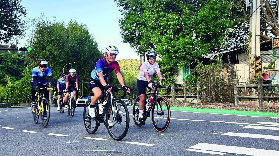
For most people, Yangmingshan is a great place for flower viewing and hiking; for cyclists, it is also an easily accessible training ground near the city. With its diverse range of climbing routes and landscapes—shifting from forests to grasslands and volcanic terrain as the elevation changes—Yangmingshan has become an iconic cycling destination in the Greater Taipei area. The Feng-Zhong-Jian (Sword in the Wind) and Palm of Tathagata (Buddha’s Palm) routes, in particular, are legendary classics well-known to many advanced cyclists. Every ascent and descent along these routes offers an opportunity to build cyclists’ riding skills while simultaneously testing their endurance and willpower.
Feng-Zhong-Jian: A Beginner's Half-Day Climbing Test
When talking about Yangmingshan’s most representative cycling route for advanced training, the Feng-Zhong-Jian (Sword in the Wind) route usually comes to people’s minds first. The route is a round trip that runs along Jiannan Road, Zhishan Road, and Zhongshe Road, and extends up to Fengguizui in Yangmingshan National Park. The entire route is nearly 30 km long, with an elevation gain of over 800 meters. Many cyclists note that this route is suitable for both beginners and experienced riders: It provides great climbing training for beginners and excellent interval workouts for experienced cyclists. For those who maintain a regular training routine, it takes about half a day to complete the route.
Chen Chen-Hsiang, an appointed interpreter at Yangmingshan National Park Headquarters (YMPH), is also an experienced cyclist. “Yangmingshan is the most popular training ground for cyclists in the Greater Taipei Area, offering close proximity to the city, well-paved roads, nice views, and a variety of routes for different skill levels.” Chen adds with a smile, “Cyclists capable of reaching Yangmingshan typically maintain a regular training routine; otherwise, they wouldn’t be able to complete the ride.” In particular, on the climb from Fenglin Bridge to Fengguizui (about 6.5 kilometers), many cyclists will time themselves to check their cycling performance.
If the Sword in the Wind route is an entry ticket to the arena of advanced challenges, the more difficult Buddha’s Palm route is considered a true rite of passage by many cyclists. “Sword in the Wind isn’t too difficult if you keep up with your training, but Buddha’s Palm is a completely different level of challenge!”
Buddha's Palm: A Cyclist's Badge of Honor
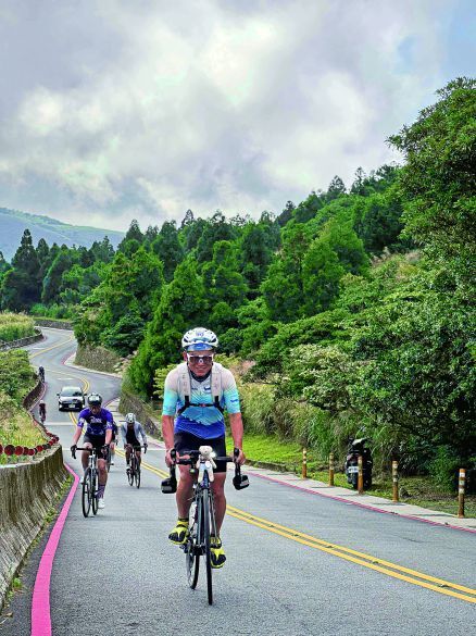
The Buddha’s Palm route covers a total distance of around 130 km and features an elevation gain of around 3,100 meters. Riders typically start near the National Palace Museum and tackle the route counter-clockwise: first climbing over Lengshuikeng, descending to Jinshan, and then following mountain roads to sequentially complete five climbs. Since the GPS track perfectly outlines a palm, the route is known as the Buddha’s Palm. It is one of the most iconic long-distance cycling routes in northern Taiwan.
 Route Map.png)
.jpg)
 Route Map.png)
When taking on the Buddha’s Palm route, the rider’s cycling ability is the first challenge. Chen notes, “To successfully tackle the route, you must be capable of climbing over 2,000 meters in a single day.” This level of ability requires long-term training to build up, and cannot be achieved quickly. “For those looking to tackle the Buddha’s Palm, incorporating more long slow distance (LSD) rides into your routine training is recommended as a core foundation for building aerobic endurance.”
Conquering the Buddha’s Palm involves far more than just defeating any single “finger” of the climb. Many riders realize only after personally attempting the route that the biggest test is the fatigue that builds up over time. This is the second challenge of tackling the Buddha’s Palm route: whether you can maintain a steady pace and sheer willpower all the way to the end.
With energy gradually depleting, the rider’s pace and mental state impact every pedal stroke, especially on the second and third fingers of the climb, where exhaustion becomes overwhelming. “It is just like hitting a wall on a long ride: your energy drains, lactic acid builds up, and your stamina wears down.” Based on Chen’s experience, the middle finger section along County Road Bei-15 is particularly difficult. “By the time you reach this point, you have already accumulated about 1,300 meters of climbing and are starting to feel exhausted. Yet, another 6-kilometer continuous steep climb lies ahead, with the latter half reaching gradients of up to 15%. Many people riding the Buddha’s Palm route for the first time struggle here and are forced to dismount and walk their bikes.”
When taking on the Sword in the Wind or the Buddha’s Palm, most cyclists use these two routes for training rather than for touring or admiring the scenery. Even so, the natural landscapes and views in Yangmingshan National Park serve as a special sort of companionship during their rides.
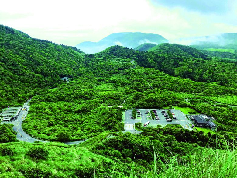
For example, the section of Balaka Highway before the climb to Erziping is well-shaded by a dense tree canopy in the summer. When cycling through the forest, sunlight filters through the treetops onto the smooth, comfortable climb, allowing cyclists to immerse themselves in the cool mountain forest. Additionally, Lengshuikeng, located along the arm of the Buddha’s Palm, is frequently shrouded in mist and fog, making it a popular spot for cyclists to stop and refill their water bottles. The expansive landscapes soothe the fatigue accumulated along the ride as cyclists take in the rolling mountains, vast grasslands, and unique volcanic terrain—a significant contrast to city views.
.jpg)


