

Accommodation in Yushan
Published: 2009-08-12

| Hotel | Tel | Fax | Address |
|---|---|---|---|
| Jian pu Lodge | 886-5-2679917 | - | - |
| Pai yun Lodge | 886-5-2679713 | - | - |
| China Youth Corps | 886-7-6866166 | 886-7-6866167 | No.55, Meishan Lane, Taoyuan Township, Kaohsiung County 848, Taiwan (R.O.C.) |
| Sheng Hwa Hotel | 886-49-2701511~3 | 886-49-2701903 | No.60,Shen-yi Road, dong-pu village,Nantou county,Taiwan(R.O.C) |
| Ya Kou Youth Hostel | 886-7-6866057 | 886-7-6866167 | No.5 Yakou ,Li-dao village, Hai-ruei Township , Taidong County |
Last Updated: 2020-11-20
Travel Guide
Published: 2009-08-12
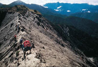
【Tataka High Mountain Ecotourism】
- Climbing Yushan Main Peak
- Day 1: Starting Point → Alishan Forest Recreation Area、Dongpu Hot Spring (lodging)
- Day 2: Alishan Forest Recreation Area、Dongpu Hot Spring → Tataka pass entry (1.7K) → Menglu Pavillion (1K) → pass entry of Yushan Front Peak (2.3K) →Forest of White Wood (1.7K) → Great Cliff (1.8K) → Paiyun Lodge (lodging)
- Day 3: Paiyun Lodge (2.4K) → Yushan Main Peak (10.9K) →Tataka pass entry→ Return
- Yushan Main Peak to Batongguan Hiking Tour
- Day 1: Starting Point → Alishan Forest Recreation Area (lodging)
- Day 2: Tataka pass entry (8.5 K) → Paiyun Lodge (lodging)
- Day 3: Paiyun Lodge (2.4 K) → Yushan Main Peak (1.8 K) → Laonong Campsite (4.2 K) → Batongguan Ancient Trail (2.8 K) → Guangao Mountain-Climbing Service Station (lodging)
- Day 4: Guangao Mountain-Climbing Service Station (14 K) → Dongpu pass entry → Return
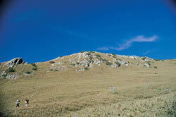
- Tataka Recreation Area --- Nature Trail Routes
- Route 1: Visitor Center (0.1K) → Dongpu Prairie(1.7K) → Tataka Police Station (0.4K) → New Central Cross Island 95K Parking Area (on foot around 12 hours)
- Route 2: Visitor Center (1.6K) → Giant Hemlock (0.8K) → Linjhih Gap (0.8K) → Linjhih Mountain (0.8K) → Linjhih Gap (0.8K) → Giant Hemlock (1.4K) → Shangdongpu (on foot around 2.5 hours)
- Route 3: Visitor Center (1.6K) → Giant Hemlock (0.8K) → Linjhih Gap (1.2K) → Lulin Mountain (0.7K) → Lulin Lodge (1.1K) → Lulin Gap → Shangdongpu (on foot around 3 hours, reverse around 4 hours)
- Route 4: Visitor Center (1.6K) → Giant Hemlock (0.8K) → trail entrance of Linchushan (2.1K) →Tataka Anbu (1.4K) → Giant Hemlock (1.4K) → Shangdongpu (on foot around 7 hours)
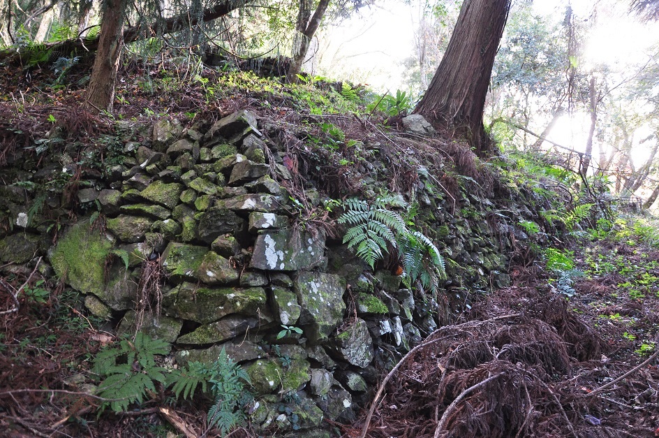
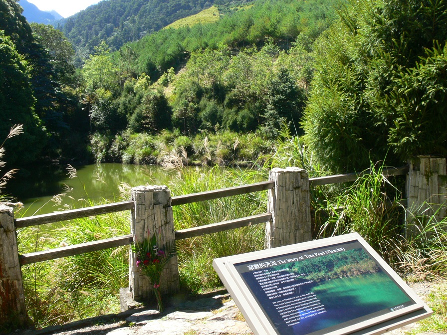
【Jhongjhihguan Ancient Trail, Southern Cross-Island Highway】
Southern Cross-Island Highway Jhongjhihguan Rest Area (30 min) → Jhihguan Police Station (20 min) → Charcoal Kiln (60 min) → Lonely Wood (15 min) →Tianchih (Tian Pond) (10) → Changching Shrine
Nanan-Walami
- 【Nanan-Walami Trail:Tour for discovering fern ecotype】
- Route 1: Trail (0.65 K) → Shanfong (0.25 K) → Shanfong bridge1 (0.8 K) →Shanfong Waterfall → Return (a round trip about 3 hours)
- Route 2: Trail (1.7 K) → Shanfong Waterfall (3.2 K) → Juasin (4.9 K) → Huangma no.1 bridge → Return (a round trip about 8 hours)
- Route 3: Trail (9.8 K) → Huangma bridge1 (0.8 K) → Huangma bridge2 (3.4 K) → Walami → Return (a round trip about 12 hours)
Last Updated: 2018-09-19
Visitor Safety
Published: 2009-08-12
Attention for visitors
【The must-know for engagement in various activities】
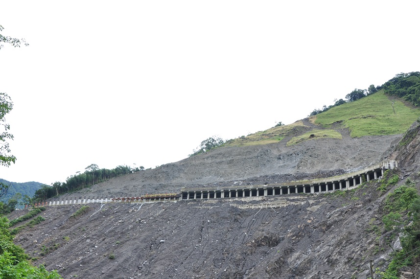
- Road conditions in the mountain area are unstable. Falling rocks or landslide could happen easily. Please do not stay or take photographs at dangerous zones where there are falling rocks and landslides.
- In the summer afternoons, intermittent rain or dense fog form frequently, whereas in winter, the surface of the road could easily freeze up and becomes slippery. Please drive carefully and reduce speed.
- Along the provincial highway, Taiwan rock-monkeys, Mikado Pheasants and Swinhoe’s Pheasant often appear. Drive carefully and please do not feed the animals.
- From June to November every year, is the breeding period for killer bees, of when they could be easily terrified and sting on people. Please be cautious.
- For mountain hiking, please equip yourself with sufficient mountain hiking equipment and in accordance with the regulations. In addition, getting mountain/park entrance permit ready beforehand is required.
- Leaving the team and acting alone, leaving the trail without the knowledge of other members and taking shortcuts are strictly prohibited during mountain hiking. Also, do not linger along the way.
- Water resource is scarce in the mountain area. Please conserve on water usage.
- Be careful while cooking with fire to avoid the outbreak of fire in the forests.
- Please do not litter and bring the garbage downhill.
- Please abide stringently on the principle of countryside activities, “Leave nothing but footprints; take nothing but photographs,” in order to protect the environment of the nature, leaving behind a land of purity for later generations.
Last Updated: 2018-09-20
Park Contacts
Published: 2009-08-12
Information of Visitor Center

| Location | Opening Hours | Contact Information |
|---|---|---|
| Administration | - | Tel:886-49-2773121 ext.605/606 Fax:886-49-775466 |
| Shuili Visitor Center | - | Tel:886-49-348269 Fax:886-49-2773121 ext. 605/606 |
| TatakaVisitor Center | 09:00am ~ 16:30pm Closed 2nd Tuesdays of the month. If that Tuesday were a national holiday, it would be postponed to the next day. | Tel:886-49-2702200~2 Fax:886-49-702250 |
| NananVisitor Center | 09:00am ~ 16:30pm Closed 2nd Tuesdays of the month. If that Tuesday were a national holiday, it would be postponed to the next day. | Tel:886-3-8887560 Tel:886-3-8880742 Fax:886-3-8880743 |
| Meishan Visitor Center | 09:00am ~ 16:30pm Closed 2nd Tuesdays of the month. If that Tuesday were a national holiday, it would be postponed to the next day. | Tel:886-7-6866181~3 Fax:886-7-6866128 |
Last Updated: 2020-11-20
Map Of The Park
Published: 2009-08-12

Yushan National Park is located in the Central Mountain Range of Taiwan. Centering around Jade Mountain Main Peak, the park covers a vast area of over 105,000 hectares spread out over the four counties of Nantou, Chiayi, Kaohsiung and Hualien. It is a typical subtropical mountainous national park.
Within the park, there are spectacular views of the peaks. The park covers 30 out of Taiwan’s One Hundred Mountains, including Jade Mountain Peaks, Siouguluan Mountain, Mabolasih Mountain, Dafenjian Mountain, Sinkang Mountain, and Guan Mountain. Each mountain has its own particular style; some are magnificently elegant and full of fury, while others display bizarre and marvelous peaks. Naturally formed, such landscapes are extremely beautiful. The park also includes the origin of the hydro system for the central, southern and eastern areas of Taiwan Province, which was closely related with the livelihood of the public at the lower reaches of the river.
Last Updated: 2018-09-19
How To Get There
Published: 2009-08-12
Transportations
- Highway Administration Information
| Shueili Area | Provincial Highway 16 | (049) 2234181 | Nantou Branch |
|---|---|---|---|
| New Central Cross-Island Highway | Provincial Highway 21 | (049) 2791510 | 2nd Maintenance Office of Sinyi Branch |
| Provincial Highway 21 - Syuefong | (049) 2702033 | 126K Station of New Central Cross-Island | |
| Alishan Highway | Provincial Highway 18 | (05) 2592426 | 5th Maintenance Office of Alishan Branch |
| Southern Cross-Island Highway | Jiasian- Meishan | (07) 751014 | 3rd Maintenance Office of Jiasian Branch |
| Haiduan- Yakou | (089) 811024 | 3rd Maintenance Office of Guanshan Branch | |
| Southlink Highway | Taitung- Dawu | (089) 325073 | 3rd Maintenance Office of Taitung Branch |
| Dawu- Fonggang | (08) 8771114 | 3rd Maintenance Office of Fonggang Branch | |
| East Coast Line | Hualien Section | (03) 8230570 | 4th Maintenance Office of Hualien Branch |
| Taitung Section | (089) 325073 | 3rd Maintenance Office of Taitung Branch |
Last Updated: 2018-09-20


